MODULES
The RITM³ digital platform has a modular structure
The modules are self-contained, can be installed on a server or work on the basis of cloud technologies. Each module has uni-fied functionality, which can be supplemented depending on the tasks.
MODULES
The RITM³ digital platform has a modular structure
The modules are self-contained, can be installed on a server or work on the basis of cloud technologies. Each module has uni-fied functionality, which can be supplemented depending on the tasks.
Modules are grouped by main functions
Each group includes a set of modules that solve a certain range of tasks. The modules are independent and can operate in stand-alone mode.
Modules are grouped by main functions
Each group includes a set of modules that solve a certain range of tasks. The modules are independent and can operate in stand-alone mode.
The unit includes a series of modules for collection, storage, analysis and visualization of transport data
The unit includes a series of modules for working with trans-portation modules
The unit includes a series of modules for working with visuali-zation of current transport data
Unit includes a series of modules for real-time control of the transport system
2
1
The unit includes a series of modules for collection, storage, analysis and visualization of transport data
ANALYSIS AND PLANNING
The unit includes a series of modules for working with transportation modules
FORECASTING AND MODELING
4
3
The unit includes a series of modules for working with visualization of current transport data
MONITORING AND REPORTING
Unit includes a series of modules for real-time control of the transport system
MANAGEMENT AND CONTROL
ANALYSIS AND PLANNING
The modules are designed to support high level decision-making on development, strategic and operational management of the transport system to increase road safety, improve traffic conditions, and ensure high quality of transport services.
Module «GIS»
A geographic information system for data acquisition, storage, analysis, and graphical visualization (GIS) is a "base" (core) module that is used by the rest of the modules to visualize and work with spatial data.
Module "GIS"
The main functions of the module are:
Main capabilities of the module:
- storage and processing of spatial data;
- loading spatial data from external sources;
- search of objects by attributes;
- visualization of background information;
- visualization of spatial data;
- modification, editing of spatial data (point, polyline, polygo-nal).
Main capabilities of the module:
- Working with spatial data (navigation, searching and filtering objects, performing measurements on the map, using back-ground maps).
- Adding objects manually and importing/exporting datasets (Data Source Manager).
- Setting up display of objects (visualization) on the map (color and volume display).
- Creation and editing of layer objects.
- Geospatial analysis ("heat map", bars, cluster display, spatial filtering).
Module «Transport Master Plan»
The module is designed to work with initiatives of a Transport Master Plan and display them at the street network.
Module "Transport Master Plan"
The main functions of the module are:
- displaying the results of Transport Master Plan initiatives as GIS objects with capability of filtering by time, quantity and cost;
- manual generation of initiatives offered in the Transport Master Plan;
- informing about the expiration of the implementation period of a Transport Master Plan initiative;
- Maintaining a register of road design projects;
- displaying of road design projects as GIS objects.
Module «Parking Management»
The module is designed to maintain information about city parking management, their costs and payment methods. It receives and displays data provided by the subsystems, leaving the management functions at the subsystem level.
Module "Parking Management“
The main functions of the module are:
- Receiving and visualization of information about parking zones;
- display of parking zones on the GIS background map;
- monitoring of parking lot capacity ratio;
- receiving and visualization of information about parking pay-ment rates;
- registration of the number of vehicles entering and leaving the parking management area;
- possibility of displaying other statistical data - collection of parking fees, utilization rate, number of parking spaces, num-ber of parking spaces for disabled people;
- analysis of places of vehicle concentration, e.g. cabs or other types of vehicles to identify potential parking lots;
- Integration with transport forecasting and modeling module and (or) traffic management scenario plan configuration mod-ule in terms of transferring information on parking lots and their capacity ratio.
ANALYSIS AND PLANNING
The modules are designed to support high level decision-making on development, strategic and operational management of the transport system to increase road safety, improve traffic conditions, and ensure high quality of transport services.
Module «GIS»
A geographic information system for data acquisition, storage, analysis, and graphical visualization (GIS) is a "base" (core) module that is used by the rest of the modules to visualize and work with spatial data.
Module «Transport Master Plan»
The module is designed to work with initiatives of a Transport Master Plan and display them at the street network.
Module «Parking Management»
The module is designed to maintain information about city parking management, their costs and payment methods. It receives and displays data provided by the subsystems, leav-ing the management functions at the subsystem level.
FORECASTING AND MODELING
The modules are designed to support high level decision-making on the development, strategic and operational management of the transport system to improve road safety, traffic conditions, and the quality of transport supply.
Module «Transport Planning and Modeling»
The module is one of the key modules and allows to create, edit and update transport model data. It is used to model traffic flows for city or region development planning, calculate the transport situation, visualize transport data and import them from PTV Visum.
Module "Transport Planning and Modeling"
The main functions of the module are:
- analysis, visualization and adjustment of the basic model;
- analysis of data on traffic flow parameters;
- modeling of traffic flow parameters on the whole transport network on the basis of collected data on transport flow pa-rameters from individual points on the transport network;
- forecasting of traffic flow parameters - modeling of these pa-rameters for a certain period of time in the future;
- forecasting of changes in the parameters of traffic flows when changes are made in the current parameters of the transport network.
Module «Digital twin»
The module is a base for forming a digital twin of the transport network and transport system, keeping technical records of traffic organization signs, as well as creating, placing and editing GIS-objects.
Module "Digital twin"
The main functions of the module are:
- construction of the transport network graph;
- displaying the transport network graph on the GIS background map;
- possibility to add attributes to nodes and links of the transport network graph;
- display of brief information of road object passports;
- maintenance and display of information on road infrastructure objects, including traffic organisation and traffic signs;
- connection of data from peripheral equipment from subsys-tems affecting the transport situation (data on traffic flow, events, etc.) to the transport model in real time;
- regular calculation of the current transport situation for all links of the transport network graph every 5 minutes;
- regular calculation of the transport situation forecast for all links of the transport network graph (up to 1 hour ahead) eve-ry 5 minutes;
- real-time visualization of the video stream from the selected video camera.
FORECASTING AND MODELING
The modules are designed to support high level decision-making on the development, strategic and operational management of the transport system to improve road safety, traffic conditions, and the quality of transport supply.
Module «Transport Planning and Modeling»
The module is one of the key modules and allows to create, edit and update transport model data. It is used to model traffic flows for city or region development planning, calculate the transport situation, visualize transport data and import them from PTV Visum.
Module «Digital twin»
The module is a base for forming a digital twin of the transport network and transport system, keeping technical records of traffic organization signs, as well as creating, placing and editing GIS-objects.
MONITORING AND REPORTING
The unit includes a series of modules for working with visualization of current transport data
Module «Situational Center»
The module is the main module for assessing the efficiency of the intelligent transport system and transport complex. It assumes integration with data from all other modules without the ability to manage existing subsystems and hardware.
Module "Situational Center"
The main functions of the module are:
- collection, processing, accumulation and visualization of the main parameters of the transport system;
- visualization of information on the map in layers, separate blocks (widgets), as well as in the form of graphs;
- display of ITS efficiency indicators with the possibility of filter-ing by different time periods (the composition of indicators depends on the set of available data): average speed of vehi-cles (km/h), average speed of public vehicles (km/h), volume of transported passengers (thousand people), average delay of vehicles, (hour/veh.), level of traffic service, number of acci-dents (units), etc;
- monitoring and visual informing of users about the perfor-mance of transport infrastructure facilities (equipment) and basic information from them.
Module «Public transport management»
The module is designed to monitor the operation of public passenger transport.
Module "Public Transport Management"
The main functions of the module:
- displaying the current location of vehicles, routes, stop points on the GIS background map;
- displaying the characteristics of public transport routes (num-ber, length, stop points, etc.);
- analyzing: speed profiles;
- maintenance of normative and reference information on the vehicle fleet, routes, stops, timetables;
- display of information from information boards installed at bus stops ("smart stops").
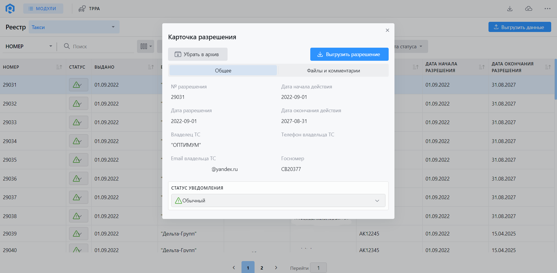
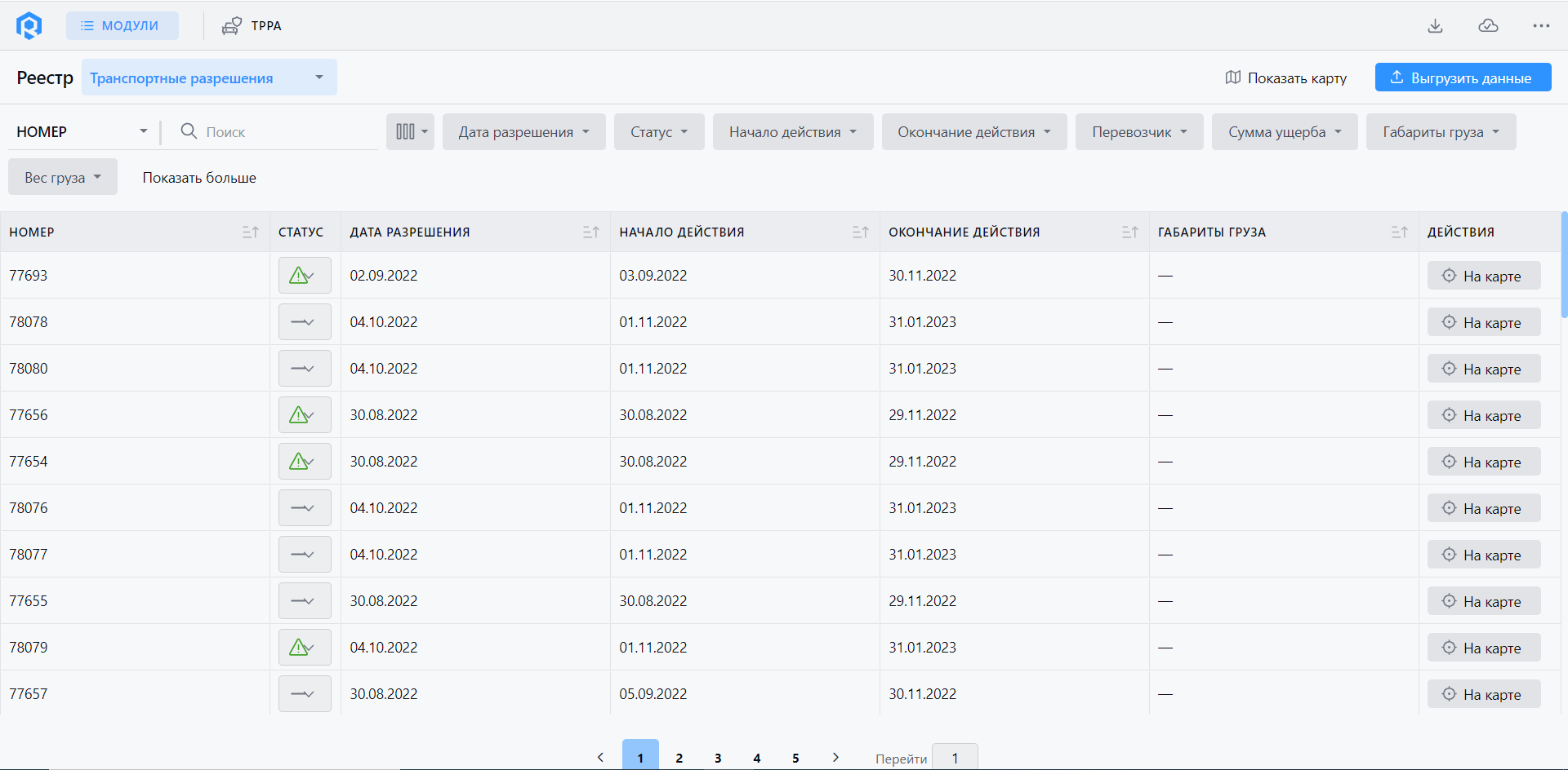
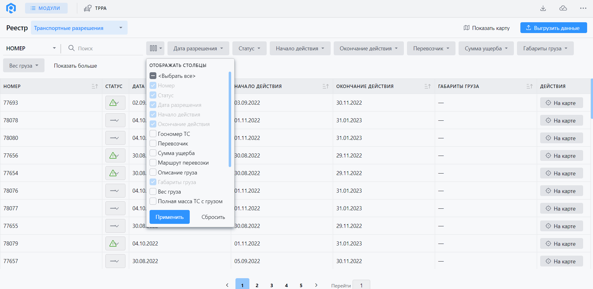
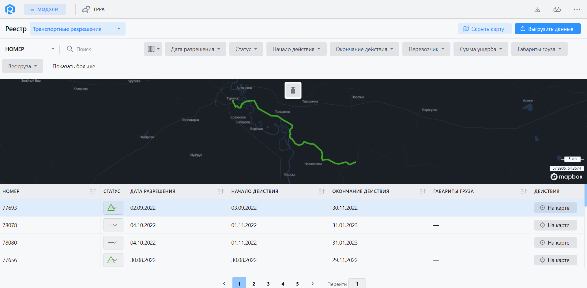
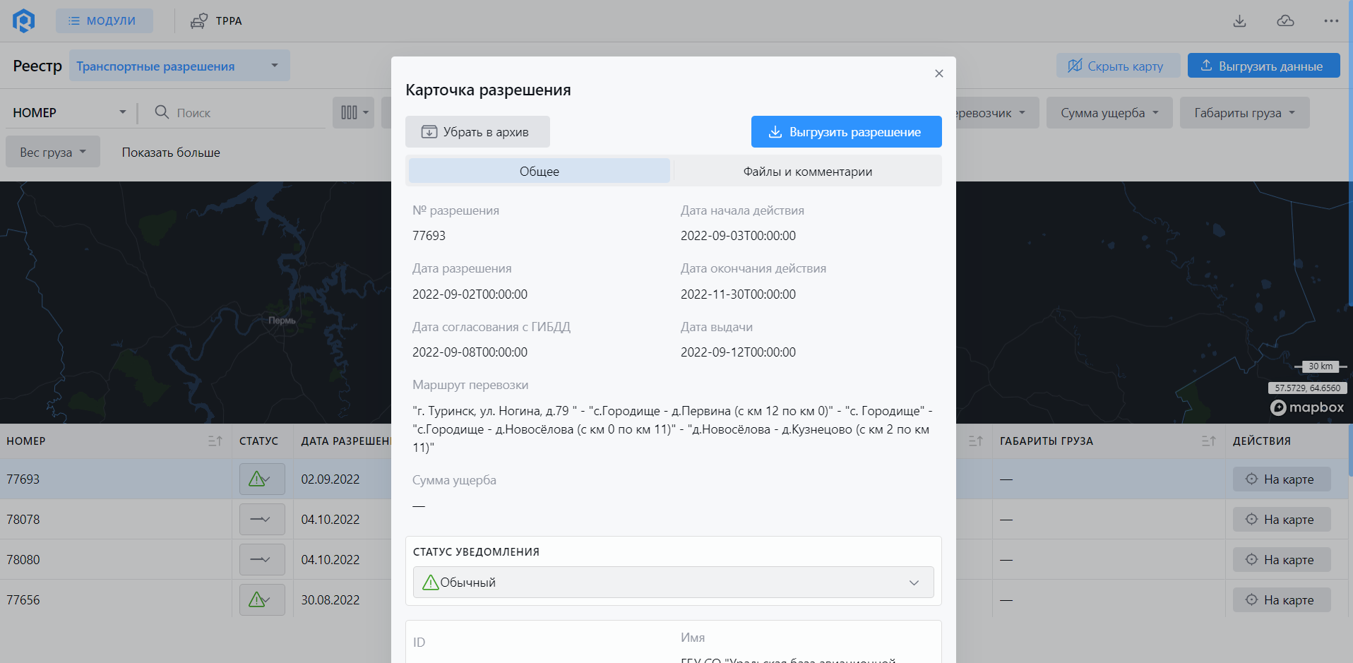
Module «Registry of transport permits and taxi»
The module is designed to work with registers of transport permits for oversized vehicles and taxi, as well as to coordinate the route of heavy and (or) oversized vehicles.
Module "Registry of transport permits and taxi"
The main functions of the module are:
- collection, accumulation, visualization and uploading of data on issued transport permits;
- display on the GIS background map the routes of heavy-weight and (or) oversized vehicles for each permit;
- display on the GIS background map the locations of weight and dimensional control points and information about them.
MONITORING AND REPORTING
The modules are designed to monitor and track the current transport situation in key areas of the transport system.
Module «Situational Center»
The module is the main module for assessing the efficiency of the intelligent transport system and transport complex. It as-sumes integration with data from all other modules without the ability to manage existing subsystems and hardware.
Module «Public Transport Management»
The module is designed to monitor the operation of public passenger transport.
Module «Registry of transport permits and taxi»
The module is designed to work with registers of transport permits for oversized vehicles and taxi, as well as to coordinate the route of heavy and (or) oversized vehicles.
MANAGEMENT AND CONTROL
The modules are designed to support high level decision-making on development, strategic and operational management of the transport system to improve road safety, traffic conditions, and ensure high quality of transport services.
Module «Road works management»
The module is designed to monitor road works and vehicles of road works contractors. The module receives and displays the data provided by the subsystems, leaving the management functions at the subsystem level.
Module "Road works management"
The main functions of the module:
- real-time monitoring of one or a group of vehicles with location display on the map, with color indication of groups or types of vehicles;
- displaying the list of road works;
- display of passed routes in the form of a track with display of vehicle speed in different colors on a pre-configured scale;
- display of vehicle idle time;
- tracking the passage of pre-defined geographical points or routes by monitoring objects;
- planning and coordination of road works (history);
- monitoring of work execution - color indication on the map about the timing and readiness of works.
- A web-application has been developed for the module for resi-dents to enter discrepancies in road and yard maintenance.
- creation of a resident's account: registration by email or phone number;
- creating a request (event);
- viewing the request (event).
Module «Adaptive Traffic Light Control»
The module is designed to receive and display data provided by adaptive traffic light control subsystems, leaving the control functions at the subsystem level.
Module "Adaptive Traffic Light Control"
The main functions of the module are:
- summary and display of information on all traffic light objects (location, statuses, current traffic light phases, coordination);
- display of information on peripheral equipment on the GIS substrate;
- viewing the performance history (statuses) of traffic light ob-jects;
- aggregation of traffic detector data on traffic flow parameters (sum, average, maximum, minimum value);
- assignment (manually) to traffic directions in connection with the graph of the transport network at the regulated intersec-tion of corresponding phases and signal programs of traffic light regulation.
Module «Centralized information of traffic participants»
The module is designed to work with data from information boards, variable information signs and other spatial means of information.
Module "Centralized informing of traffic participants"
The main functions of the module are:
- display of information boards, variable information signs and other spatial means of informing on GIS background map;
- display of statuses and posted content on the means of infor-mation.
MANAGEMENT AND CONTROL
The modules are designed to support high level decision-making on development, strategic and operational manage-ment of the transport system to improve road safety, traffic conditions, and ensure high quality of transport services.
Module «Road works management»
The module is designed to monitor road works and vehicles of road works contractors. The module receives and displays the data provided by the subsystems, leaving the management functions at the subsystem level.
Module «Adaptive Traffic Light Control»
The module is designed to receive and display data provided by adaptive traffic light control subsystems, leaving the control functions at the subsystem level.
Module «Centralized information of traffic participants»
The module is designed to work with data from information boards, variable information signs and other spatial means of information.
DEMO RITM³
The digital platform is in active development and we regularly publish major updates, additions and extensions in the Blog.
Subscribe to news in Telegram (in Russian – use translate)
Subscribe to news in Telegram (in Russian – use translate)
The demo presents part of the functionality of the platform. Demonstration of all available modules and capabilities of the platform is conducted as part of presentations by SIMETRA transport engineers.
Contact us
If you have any questions about the features of the digital platform, how individual modules work, integration features and product costs, email us or give us a call.
moscow@simetragroup.ru
spb@simetragroup.ru
spb@simetragroup.ru


